The Aggregates Industry and the Aggregates Levy Sustainability Fund
Quarrying is one of the oldest industries in the world. The long-standing demand for geological materials for building stones and aggregates means that the historic remains of both large and small scale quarrying activity is evident throughout the British landscape. Aggregates include sands, gravels and crushed rocks. These are principally used in infrastructure and industry and in our everyday lives we all depend on aggregates.
Aggregates extraction also provides employment and often exposes important geological features, which otherwise might not be discovered. Conversely extraction of aggregates can affect irreparable damage to historic and archaeological landscapes and often has negative effects on biodiversity. Quarry noise and traffic can be a problem for rural communities.
In 2002 the Aggregates Levy Sustainability Fund (ALSF) was introduced to help offset the environmental and social affects of aggregates extraction. The Quarrying companies pay a tax on each ton of aggregate produced. The resulting fund is distributed via various government bodies dependant on the projects being funded. In the case of projects relating to geodiversity and biodiversity the fund is administered by Natural England (formerly English Nature).
Aggregates extraction sites are found throughout the Geopark. These sites cluster around the Abberley and Malvern Hills, the May Hill area and the Wyre Forest. Crushed limestone and sandstone aggregate from these areas were used for the construction and repair of local roads and crushed lime was used on agricultural land as a soil improver. In the past disused quarries were often used as landfill sites, nowadays they are more likely to be sympathetically restored and transformed into nature reserves. Increasingly disused quarries are conserved for their geodiversity as well as their biodiversity and quarry sites are managed to benefit local communities ensuring they have access to important Earth heritage sites. The Geopark and its partners have all benefited from ALSF monies to fund site restoration works, management plans and community projects at former aggregate extraction sites.
You can find out more about the Aggregates Levy Sustainability Fund on the Natural England website under 'Grants & Funding'.
 The River Teme winds its way through Herefordshire and Worcestershire. The Teme valley is notable especially in the Shelsleys area for the locally abundant deposits of tufa and travertine. These calcium rich deposits formed, and in some cases are still forming, as spring waters are discharged through the underlying limestones. Travertine is the harder form of the calcium carbonate deposit known as tufa and was used locally for building stones. A prime example is the church of St Andrew in Shelsley Walsh but there are many other examples of local buildings where tufa and travertine were utilised for building stone or decorative features.
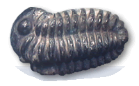
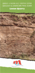 Linton Quarry is a former aggregates and building stone quarry, one of several disused workings in the area around Gorsley. Linton Quarry is unique because it contains the best documented sequence of Silurian rocks in the area. For this reason, it has been designated a Site of Special Scientific Interest and a Local Geological Site.
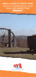 The Wyre Forest Coalfield covers an area of about 50 square kilometres. The area around highly was an important part of this significant resource. Extraction of the various rock types within the coalfield has occurred since medieval times, thus contributing to the economy and character of the area.
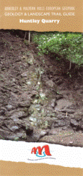 Huntley Quarry contains some of the oldest rocks in Gloucestershire, including the only known exposure of the Huntley Quarry Beds. The age of the quarry is unknown, but was certainly in use in the 1830’s when Robert Murchison, the famous geologist who established the Silurian system, was working in the May Hill area.
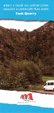 Tank Quarry is one of the largest and most prominent hard rock quarries on the Malvern Hills. The quarry contains exposures of igneous rocks that are approximately 700 million years old, from the Precambrian period. This makes them the oldest in Worcestershire, and amongst the oldest in the UK.
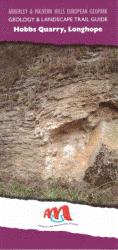 Hobbs Quarry is a unique site containing rare exposures of a fossilised reef. For this reason, the site has been designated a Geological Site of Special Scientific Interest, and a Regionally Important Geological Site. The site is also a nature reserve owned by Gloucestershire Wildlife Trust.