The Geopark is a particularly special area of the country as so many geological periods are represented. The story of geological time is written in the landscape from the ancient rocks of the Malvern Hills (700 million years old) to the 'recent' glacial and river deposits in the valleys of the rivers Rea, Severn, Stour, Frome and Leadon. There are a variety of trail guides available exploring geology and landscape, and the building stones seen within the Geopark. The trail guides presents these geological stories to visitors who enjoy the countryside and would like to know a little more.
The Trail locations are marked on the map below. To download the trail locations map click here. You will need Adobe Acrobat Reader
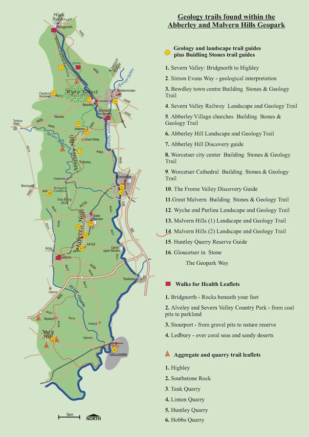
GEOLOGY AND LANDSCAPE TRAILS PLUS BUILDING STONE TRAILS
1. Severn Valley: Bridgnorth to Highley.
This trail sets out to show three chapters of the same story: The formation of the Severn Valley between Bridgnorth and Highley. It starts in Bridgnorth where the Severn has, since the last Ice Age, cut deeply down through the sandstone rock. You then go downstream to Eardington. Here you can follow the sequence of river terrace formation from the oldest (and highest) down to the present day flood plain. Finally at Severn Valley Country Park at Alveley and Highley you see how the presence of harder rocks of the coal measures have resisted erosion more and caused narrowing of the valley.
On the way you will see how the rock has been exploited over the centuries with sand and gravel extraction at Eardington and stone quarrying and coal mining at Highley and Alveley.
To order a copy click here
2. Simon Evans Way
Features of geological interest - a hundred million years walk. Prepared for the Cleobury Mortimer Footpath Association. 22pp.
To view the guide click here
3. Bewdley Town Centre
Building Stones & Geology Trail
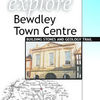 This walking trail shows how the location of Bewdley has been influenced by the underlying rocks and the River Severn. You will see that a major break in the Earth's crust runs right through the centre of the town and you will learn about the evolution of the river since the Ice Age. The trail takes you to buildings where stones of various types and origins have been used in construction; stones that were once molten rock or were formed in tropical seas millions of years ago.
This trail takes approximately one hour to complete.
ISBN: 0-9543572-5-6
Download an order form here
4. Severn Valley Railway
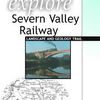 Landscape and Geology Trail
This trail runs from Kidderminster to Bridgnorth. Steaming through geological time on the Severn Valley Railway, in the comfort of a railway carriage, you will encounter landscapes created in hot, dry deserts, steamy tropical swamps and exceedingly cold Ice Age conditions. You will see how the underlying rocks and the erosive effects of the river have influenced the landscape.
A round trip, with stopping times at Kidderminster and Bridgnorth takes approximately three hours to complete. A one-way journey takes one and a quarter hours.
ISBN: 0-9535054-4-8
Download an order form here
5. Abberley Village Churches
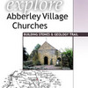 Landscape & Geology Trail
A short, pleasant walk links the two Abberley churches. This trail explains the building stones used in the Norman church of St Michael, which is built on Saxon foundations, and the 150 year old church of St Mary.
This trail takes approximately one and a quarter hours to complete.
ISBN: 0-9548360-5-7
Download an order form here
6. Abberley Hill
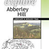 Landscape & Geology Trail
The Abberley Hills provide some wonderful scenery and viewpoints in north-west Worcestershire. This guide describes the landscape and explains its origins and takes you on a walking trail largely along the Worcestershire Way. The Way is a long-distance footpath that passes many old workings where the rocks have been quarried in the past for roadstone or building stone.
This trail takes two to three hours to complete.
ISBN: 0-9548360-2-2
Download an order form here
7. The Abberley Hills Discovery guide
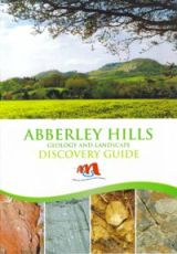 The Abberely Hills Discovery Guide is a 22 page booklet that describes the geology and landscape of this scenic area. The Hills are characterised by wooded hills, bordering the flat Worcestershire plain, extending north from Knightwick where the River Teme breaks the line of hills, to the north-easterly curving hills of Abberley, Great Witley, Martley, Berrow Green and Knightwick.
The guide contains general information about the Abberley and Malvern Hills Geopark, as well as information on accomodation & food, local tourist attractions and public transportation in the area.
Download an order form here
8. Worcester City Centre
 Building Stones Trail
The trail starts and finishes at the Guildhall, on the High Street. This elegant eighteenth century building is one of the finest Guildhalls of its type in the country and is a harmonious blend of brick and natural stone. The examples of building stone, which are described in the guide, have been selected to illustrate both local types, usually found in the oldest buildings and more exotic rocks which became available later.
The trail follows a circular route and takes about one and a half hours to complete.
ISBN: 0-9543572-1-3
Download an order form here
9. Worcester Cathedral
 Building Stones Trail
The building stones used in Worcester Cathedral were formed in many different time periods and in many different geological environments. This trail is an introduction to time travel through the geological periods in the magnificent setting of Worcester Cathedral. The cathedral has been the subject of several phases of construction and restoration. As you walk around you will see that different architects have used a diverse range of building stones in their work. This guide identifies and explains the origin of some of these stones.
This building stones trail takes two to three hours to complete.
ISBN: 0-9535054-5-6
Download an order form here
10. The Frome Valley Discovery Guide
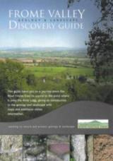 The Frome Valley Discovery Guide, which has been well received by the general public, is written in a way that is easy to understand and describes places that can be easily visited. This colourful 24 page guide takes you on a journey down the River Frame from its source to the point just east of Hereford where it joins the River Lugg. It gives an introduction to the geology and landscape in this beautiful, little known part of the Herefordshire countryside, explaining how the scenery is influenced by the variety of the underlying rock structure.
The maps in the guide show you the routes which can be used to explore the places described. You can look at rocks containing fossils of creatures which lived in clear tropical seas, see channels of streams which crossed a semi-arid land surface about 400 million years ago, the building stones used in churches or abandoned valleys which no longer have a streamhttp://www.geopark.org.uk
Every page has diagrams and colour photographs. There is also information about other sites of interest and places where visitors can stay as well as general tourist informationhttp://www.geopark.org.uk
ISBN: 978-0-9548360-8-5
Download an order form here
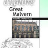
11. Great Malvern
 Building Stones Trail
Great Malvern is characterised by the presence of the local Malvern rock. However it is also possible to see a number of other rock types used as building material. This guide aims to introduce the visitor to aspects of geology through the use of building stones, both local and far-travelled. In addition, the trail illuminates the connection between the development of the town on this site because of its geographical location and the natural resources of water and stone.
This trail takes approximately one hour to complete.
ISBN: 0-9535054-6-4
Download an order form here
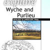 12. Wyche and Purlieu
Geology & Landscape Trail
This walking trail covers a diverse range of landscape and geology features. The visitor will take in views across the relatively flat Severn Plain and compare them with views across the rolling limestone hills of eastern Herefordshire. The visitor will also walk over some of the oldest rocks in the British Isles, before descending through terrain that once graced the bottom of a warm shallow sea. The route follows part of an old salt way, a pack horse track used for transporting salt from Droitwich. The track ran from the Rhydd Ferry on the River Severn, across the Malvern Hills at the Old Wyche Road, down The Purlieu and on to Bosbury.
This trail takes approximately two hours to complete.
ISBN: 0-9543572-0-5
Download an order form here
13. Malvern Hills (1)
 Landscape & Geology Trail
The ancient rocks of the Malvern Hills form a boundary between the relatively flat Severn Plain of Worcestershire and the gently rolling hills of Herefordshire. This guide explains these different landscapes - how they were formed and how they have been modified. It is a story of dramatic earth movements, warm shallow seas, hot deserts and freezing conditions over a timescale of 700 million years.
This trail takes approximately two hours to complete.
ISBN: 0-9535054-7-2
Download an order form here
14. Malvern Hills (2)
 Landscape & Geology Trail
The rocks of the Malvern Hills form a natural boundary between Worcestershire and Herefordshire. This guide illustrates and explains the landscape that you can see whilst walking around Midsummer Hill, situated near the southern end of the Malverns. It tells a tale of deep Earth processes, tropical seas, deserts and ice ages.
This trail takes about two hours.
ISBN: 978-0-9548360-7-8
Download an order form here
15. Huntley Quarry Reserve Guide
The Huntley Quarry Geological Reserve and its surrounding woodland is owned and managed by Gloucestershire Geology Trust. The reserve guide explains the unique geology demonstrated in a series of exposures, and how the Blaisdon Fault, which runs through the centre of the reserve, has affected the structure of the rocks. It describes the environments in which these rocks formed, the major earth movements they have been subjected to, the research carried out to determine the age of the rocks, and the ecology and biodiversity of the area.
To order your copy click here
 16. Gloucester in Stone
Gloucester in Stone explores the fascinating range of building stones that that make up the urban fabric of central Gloucester. The guide looks at the variety of local and imported stone used, why some stones are more popular than others, and how the use of building materials has changed over time.
To order your copy click here
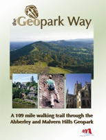
Winding its way from Bridgnorth, Shropshire, to Gloucester, for 109 miles the Geopark Way trail passes through delightful countryside as it explores 700 million years of Earth’s history. The associated trail guide interprets the sites and vistas seen on route, drawing attention to how geology has played a significant part in influencing the wildlife, archaeology, social and industrial history of the area.
The trail offers varied walking alongside rivers, through forests, along ridge-tops and across heath-land. Quaint villages and towns dot the route bringing further elements of exploration and enchantment.
More information about the Geopark Way is available on Herefordshire and Worcestershire Earth Heritage Trust's website, where you can also download an order form.